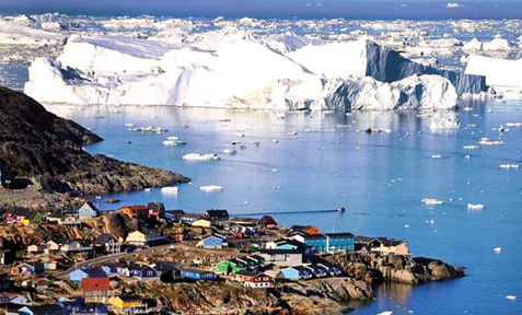
Greenland ice sheet could be melting faster
The Greenland ice sheet - the largest body of ice in the northern
hemisphere - could melt faster than scientists had previously thought
according to two independent studies suggesting that the loss could lead
to a more rapid rise in global sea-levels.
Satellites studying the height of the Greenland ice sheet at 100,000
sites show that it has lost about 243 billion tons - equivalent to 277
cubic kilometres - of ice each year between 2003 and 2009 contributing
0.68mm to annual average sea levels, scientists said.
This is the first comprehensive snapshot of how Greenland’s ice is
vanishing, and suggests that the current computer models used to predict
how it will continue to lose ice are too simplistic, and that the
melting may be quicker than previously thought, said Beata Csatha of the
University of Buffalo in New York.
|
First comprehensive snapshot of melting ice brings bad news |
Current predictions of Greenland ice-loss are based largely on the
activity of four well-studied glaciers but this simplistic approach may
have missed regions that are melting much faster, Dr Csatha said.
“There are 242 outlet glaciers wider than 1.5km on the Greenland ice
sheet, and what we see is that their behaviour is complex in space and
time. The current models do not address this complexity,” she said.
The study, identified for instance rapid shrinking of the ice sheet
in southeast Greenland which had not been picked up by the models,
leading the scientist to suggest that they may have underestimated just
how fast Greenland will melt.
The second study, published in the journal Nature Climate Change,
found that the supraglacial lakes that form on the surface of the ice
sheet during summer will begin to appear further inland away from the
coast this century, potentially increasing the rate at which the ice
overall disappears.
“Supraglacial lakes can increase the speed at which the ice sheet
melts and flows, and our research shows that by 2060 the area of
Greenland covered by them will double,” said Amber Leeson of the
University of Leeds, the lead author of the study.
When lakes form on top of the ice sheet they absorb more heat because
theyare darker than the ice they sit on. The meltwater of lakes formed
further inland also tends to drain to the base of the ice sheet,
increasing the rate at which the ice flows to the sea.
Existing lakes form on the ice sheet about 100km from the coast,
which is at a lower, and warmer altitude than the interior. However, the
latest study suggests that lakes could spread much further inland, by up
to 110km.
“The location of these new lakes is important. They will be far
enough inland so that water from them will not drain into the oceans as
effectively as it does from today’s lakes that are near to the coastline
and connected to a network of drainage channels,” Dr Leeson said.
“In contrast, water draining from lake further inland could lubricate
the ice more effectively, causing it to speed up,” she said.
Current computer models suggest that the Greenland ice sheet will
contribute to about 22cm of sea-level rise by 2100. However this
estimate does not take into account the distribution of the new lakes
identified by Dr Csatha and her colleagues.
Greenland ice sheet: Facts and figures
The Greenland ice sheet covers 1.7 million square kilometres, roughly
80 per cent of the surface of Greenland.It is the second largest ice
body in the world, after the Antarctic ice sheet. Scientists believe it
contains enough water to push up sea level by six metres if it all
melted.
Since 2003 warming in north-east Greenland has seen the sheet lose
about 10 billion tonnes of ice a year.
- The Independent
|


")


