Managing traffic
 One
of the biggest problems facing commuters in our major cities, especially
Colombo and Kandy, is heavy traffic. Traffic speeds in rush hour Colombo
is down to almost 8 Km/h and it is predicted the speed will come down to
around 3 Km/h in a few years. Heavy traffic wastes our time, fuel and
energy and does no one any good. One
of the biggest problems facing commuters in our major cities, especially
Colombo and Kandy, is heavy traffic. Traffic speeds in rush hour Colombo
is down to almost 8 Km/h and it is predicted the speed will come down to
around 3 Km/h in a few years. Heavy traffic wastes our time, fuel and
energy and does no one any good.
The one thought that enters our mind while being stuck in traffic is
often "isn't there another, traffic-free road that I should have taken?"
There is often no way that you could know about roads with less traffic
congestion, although some radio stations occasionally give traffic
updates about certain roads in Colombo an suburbs. The other method is
usually word of mouth, where a co-worker or friend tells you about a
nightmarish traffic condition on the road he or she is taking. But apart
from these methods, there is no real-time traffic information. There is
one smartphone app that gives traffic information relaying on user
feedback, but this is still a work in progress.
Predictions
 Google Maps has been available for Sri Lanka for quite some time now
and it usually gives remarkably accurate predictions for travel times
from A to B. However, these are based on the assumption of having normal
(i.e. fast moving) traffic. Up to now, there was no real time traffic
info on Google Maps. Now Google has rectified this shortcoming and
activated real-time traffic information for Sri Lanka with useful
congestion data for Colombo and other locations. Google Maps has been available for Sri Lanka for quite some time now
and it usually gives remarkably accurate predictions for travel times
from A to B. However, these are based on the assumption of having normal
(i.e. fast moving) traffic. Up to now, there was no real time traffic
info on Google Maps. Now Google has rectified this shortcoming and
activated real-time traffic information for Sri Lanka with useful
congestion data for Colombo and other locations.
This is great news for motorists, but there are some caveats. First,
the driver should have a smartphone that can access and display Google
Maps. These days, any smartphone can do that. Second, the driver should
be in an area with a 3G or 4G mobile data signal. Again, this should
pose no problems in the major cities which have blanket 3G and 4G
coverage. The maps are thus available for any location where there is
mobile data and slow-moving traffic.
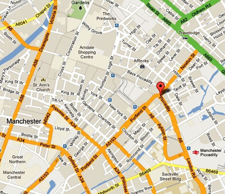
The Google map will indicate routes in green color for those where
the traffic is moderate while heavy traffic is indicated by red colour.
To make use of this facility, commuters need to access Google maps and
select "Traffic" from the menu to commence the traffic route guide.
Another rather helpful feature is that the Google map displays road
construction zones as well. These can often lead to traffic snarls, so
users can be warned beforehand.
Experience
Since it is available on Google maps for both mobiles and desktops,
travellers will be able to check current traffic conditions on their
desktop at the office and choose a less traffic-chocked street before
heading out to the car park. The best part of the experience is that it
will be a collective effort of smartphone users - if Google Maps is used
for mobile with GPS enabled on your phone, then Google Maps starts
accumulating data on travellers necessary for traffic estimations. When
a driver chooses to enable Google Maps with My Location, the phone sends
anonymous bits of data back to Google describing how fast the vehicle is
moving. "When we combine your speed with the speed of other phones on
the road, across thousands of phones moving around a city at any given
time, we can get a pretty good picture of live traffic conditions," says
Google.
Google aggregates this data and sends it back to Google Maps traffic
layers. When Google Maps for mobile is turned on, the resulting traffic
reports are fairly accurate versions of what goes on, on our roads.
Smartphone
Does Google or your mobile operator know where you are? Are there any
other privacy concerns? While commercial vehicle tracking software does
exist, this is not a tracking system, but rather a collective traffic
reporting system that has already been tried and tested many other
countries. In any case, to address privacy and security concerns, when a
lot of people report data from the same area, Google combines data
together to make it hard to tell one smartphone from another. Google
apparently deletes your trip data once the trip under review is
terminated. In case you are worried about any privacy issues, you can
always turn this feature off.
With
Google already engaged in collecting Street View data for 3-D maps of
the length and breadth of Sri Lanka, this will be an ideal navigation
aid that can inform drivers in real time about traffic conditions on the
roads they intend to take. It is an ideal journey planner. If more
drivers opt to make use of this feature, it has the potential to spread
out the traffic evenly across the available roads and thus make all
roads more accessible. Most people stick to a familiar road day after
day without considering another route that might be less congested and
this might convince them to take the plunge. One has to try the unknown
and the unfamiliar to make new discoveries, after all.
Objective
However, this is only a partial solution to our traffic woes. The
authorities want to discourage owner-drivers from coming to the city of
Colombo alone, without at least two other passengers.
A penalty for those who do not engage in such 'car-pooling' has
already been proposed to be implemented from the latter part of next
year.
The shared ride service Uber, which has already entered Sri Lanka,
has shown that this could be financially rewarding for both the driver
and his/her passengers. The concept might work in Sri Lanka if marketed
properly.
The best solution is still not to drive to work altogether. But this
is easier said than done. The best alternative is to build a world class
public transport system (trains, bus rapid transit, taxis - not three
wheelers) that rivals any such system in Asia.
If there is a good, efficient, clean, public transport network that
covers the entire city and the suburbs, most people would not want to
get into their vehicles except on holidays. That should be the city and
traffic planners' ultimate objective. |