Seattle prone to quakes, landslides
With its coastal bluffs, roller coaster hills and soggy weather,
Seattle is primed for landslides even when the ground isn't shaking.
Jolt the city with a major earthquake, and a new study from the
University of Washington suggests many more slopes could collapse than
previously estimated.
|
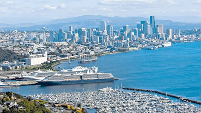
The Seattle waterfront |
A powerful earthquake on the fault that slices under the city's heart
could trigger more than 30,000 landslides if it strikes when the ground
is saturated, the analysis finds. More than 10,000 buildings, many of
them upscale homes with water views, sit in areas at high risk of
landslide damage in such a worst-case scenario.
"Our results indicate that landsliding triggered by a large Seattle
fault earthquake will be extensive and potentially devastating," says
the report published this month in the Bulletin of the Seismological
Society of America.
Coming on top of widespread damage to buildings and infrastructure
caused by the quake itself, landslides would compound the city's
problems and slow its recovery, said lead author Kate Allstadt, who
recently earned her doctoral degree in seismology.
"I think the message is that we need to pay much more attention to
these earthquake-induced landslides," she said.
The Puget Sound-area landscape is pocked with scars from slides
triggered by ground shaking, but the worst of them occurred long before
cities existed here. The last quake on the Seattle Fault, about 1,100
years ago, shook the ground so hard that entire hillsides slumped into
Lake Washington, carrying intact swaths of forest with them. Tree-ring
dating from some of those submerged firs helped establish the quake's
date. Scientists estimate its magnitude at about 7.5.
Researchers studying lake-bottom sediments have also unearthed a
record of as many as seven landslide episodes linked to earthquakes in
the past 3,500 years.
Even the relatively modest Nisqually earthquake in 2001 - which
occurred during an unusual winter dry spell - set off about 100
landslides.
Allstadt, a New York native, became intrigued with landslide risk
soon after she got her first look at Seattle's up-and-down terrain and
learned about the region's seismic history. Though the city has good
maps of landslide zones, most of the emphasis has been on the
garden-variety slides caused by wet ground.
"Because so many landslides were triggered by the last earthquake on
the Seattle Fault, it was really surprising to me that no one had looked
in detail at what would happen today, when those hillsides are covered
with houses," Allstadt said.
She and colleagues John Vidale, of the University of Washington, and
Art Frankel, of the US Geological Survey, set out to answer that
question by simulating the effects of a magnitude-7 quake on the Seattle
Fault. The fault, which is actually a wide band of subterranean
fissures, extends from Bremerton to the Cascade foothills, crossing
under West Seattle, Puget Sound and South Seattle.
Thanks to modern computing power and new insights into the way
seismic waves bounce around in the sedimentary basin that underlies much
of Seattle, Allstadt was able to create a very detailed picture of how
shaking would vary across the city, said Tim Walsh, geologic hazards
chief for the Washington Department of Natural Resources.
"It represents a huge effort," he said.
Allstadt then factored in topography and soil type, along with what's
already known about the stability of landslide-prone slopes. Not
surprisingly, when she allowed her scenario to play out under dry
conditions, the number of potentially destructive landslides was much
lower: About 5,000, compared with the 30,000 predicted when the ground
is sopping wet.
But Allstadt was surprised that about a third of the simulated
landslides in both wet and dry conditions struck in areas that aren't on
the city's landslide hazard maps. That includes some inland areas, where
the threat of landslides has been assumed to be low.
In general, landslide damage was much more severe in neighbourhoods
close to and south of the fault, where shaking is expected to be
strongest. That includes much of West Seattle, Beacon Hill and Mount
Baker -- though if a big quake hits when the ground is wet, Allstadt's
simulations predict lots of slides in North Seattle as well as along all
of the region's coastal bluffs.
The new study looks at only one possible quake and two sets of soil
conditions: Bone dry and sopping wet. To help the city improve its
hazard mapping, it would be necessary to consider multiple earthquake
magnitudes and varying moisture levels, Walsh pointed out.
The UW study also didn't examine the landslide consequences of a
coastal megaquake, like the one that struck the Northwest in the year
1700 - and which is certain to happen again. Measuring magnitude 9 or
more, coastal megaquakes are far more powerful than those the Seattle
Fault can generate.
But for the city itself, a large quake on the hometown fault would be
more destructive, because the force is concentrated directly under the
urban area.
Geologists still don't have a good handle on how frequently the
Seattle Fault ruptures, but they have uncovered evidence of at least
three powerful quakes in the last 2,500 years.
According to one scenario, a magnitude 6.7 quake on the Seattle Fault
could kill 1,600 people and cause $33 billion in damage. That analysis
glossed over the damage caused by landslides, but in major quakes,
collapsing hillsides can cause as much - or more - destruction than the
shaking itself, Allstadt pointed out.
More than half of the damage in Alaska's 1964 Good Friday earthquake
was due to landslides. In China's 2008 Sichuan earthquake - notable for
widespread damage to schools - more than 60,000 landslides were
responsible for tens of thousands of deaths.
Allstadt's analysis also shows that utility lines and roads in the
Seattle area - including Interstate 5 where it passes along Beacon Hill
- are at risk from landslides.
The Seattle Times
|


")

