|
| Sunday, 27 November 2005 |
| Features |
| News Business Features Editorial
|
'LANKAN TERRAIN': Key to determining military strength by Lt Col Susantha Seneviratne, RWP,RSP,Psc, Msc (def)-retd
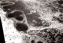
"If we cannot fathom the designs of neighbouring states and our own terrain, we cannot enter into alliances ...Those, who do not know the conditions of mountains, forests, high and dangerous grounds, defiles, marshes, and swamps cannot conduct the march of an army"-Sun Tzu. "There is only one right in the world and that right is one's own strength" -Adolf Hitler, on war (1932). These are fine military quotations that enunciate the significant importance of 'terrain' of the land and the strength of military. The 'terrain'; in other words is topography, layout of ground or the physical configuration and features of a tract of land. One might misperceive the fact that the terrain becomes a vital factor, only in the military; it is, not so. The terrain does 'command' and 'govern' everything on this planet - human, beasts, creatures, vegetation, including man made objects / creations; thus controlling the inception, existence, and the termination of everything. Creation / origination of the terrain, of course is learnt to be the result of 'reactions' of various 'magnetic forces' operating in the universe /galaxy, which are the 'ultimate' controlling agents of both, terrestrial and celestial bodies. Besides, the 'climate' and 'weather', which is the 'sister' controlling agent of the terrain is, also playing an almost equal role, by controlling the existence of everything on the planet. Needless to mention how the climate and weather would effect/affect military operations, despite the famous 'motto'- "any terrain-any weather"; used to highlight the 'adaptability'- the principal characteristic of the 'foot infantry'; 'the queen of the battle'. It is interesting note that politics, military and economy - the 'triple' principal factor/field that would ensure the 'prosperity' of a nation, depend on the terrain; the politics, in terms of 'geo' and 'administrative' politics; the military, in terms of defence of the land; the economy, in terms of basic/essential 'infra-structure'. Analysis The military reckon the terrain or in generic term, the 'ground' as a factor, which must be given the highest priority over the all other factors, such as enemy /insurgents /terrorists and their capabilities when planning operations. This is because, the capability of both 'sides' depend on the 'lay' of the land, which is the terrain. The strategy, tactics, and the use of weapons, equipments, guns, motors, crafts, vessels, etc employed by the both enemy and own forces are governed /dictated by the terrain, based on the inherent 'characteristics' and 'limitations' of the nomenclature of these military hardware. The teaching on military strategy and tactics, which encompasses the basics, fundamentals, principles, concepts, doctrines, etc vary, depending on terrain factor. The military, however much is modernized with advance and sophisticated weaponry and hi-tech equipment systems, would be a waste, if the terrain has, not been precisely analyzed; to employ them and to apply suitable strategy and tactics, accordingly to achieve military objectives; so would be with troops, even those, who are highly trained. In military courses overseas, the terrain analysis is given much attention and coverage to such an extent, by allocating a separate teaching module to lay emphasis on this aspect. The 'professionalism' in military is, therefore basically founded upon the ability to analyze this factor meticulously and accurately, so as to derive workable solutions to defence/security needs through a mechanism called 'strategic and tactical appreciation'; the logical sequence/formula of rationalization process, which mainly focuses on terrain. Intelligence It is an imperative requirement in the military to keep relevant terrain data stored as a 'ready-reckoner'; to be used for operational needs whenever necessary. In professional military forces, the intelligence unit is the one that is responsible for this work, and whose 'primary task' is to gather, study, analyze and store the terrain data. The sources of gathering terrain information, primarily can be obtained from the combat / field soldiers, who use their 'eyes and ears', aerial /satellite photos, various types of patrols operating on land sea and air, and the informants, whose reliability must be vetted carefully for the veracity. As much as the information on adversary, the same on terrain is, absolutely essential to build an intelligence picture; this is why the 'terrain intelligence' does function as a separate entity in the form of a branch / wing in the same organization, and is handled by 'specialized' personnel, who have a thorough knowledge of ground analysis. The information obtained/provided by various sources, especially from the informants and those, who have surrendered, themselves, must be verified for 'credibility'; to prevent from 'spying' and carrying out 'espionage' ('double agents' work'); as experienced by the intelligence services of the country, today and, which has led to the recurrent assassination of intelligence personnel, at present. It has been the task of the 'spy' and 'espionage' cell of the intelligence wing of the LTTE to send their trained carders under the pretext of 'surrender'; to join the intelligence unit of the military for accomplishing the 'missions' of spy and espionage; the 'covert'/ 'clandestine' nature of 'coup-de-man' operations. The LTTE began this activity in 1985 -1986; in the peninsular of Jaffna. Once they 'manipulated' a spy for nearly two years, who acted as an informant, by aiding to recover bombs, mines, parts of weapons, etc (all were in the state of obsolete/out of use); thus winning the faith not, only of 'one' company commander but, also of the most officers, who were, then at command and staff levels in the peninsular, until he 'decoyed' troops into an ambush at a location close to the village -'Thalladi' - situated northeast of Elephant Pass; killing 12x soldiers, and injuring the rest and recovering their weapons/equipments. However, no intelligence unit in the country, today handles 'terrain intelligence'; what they provide, as a result is the information- not intelligence. There is a 'subtle' nuance between these two aspects. The information is, simply what you get but the intelligence is the 'picture' what you build; based on what you get (information); of what your adversary is going to do. Perception The 'threat perception' is a pre-requisite factor in the military appreciation to be analyzed, in parallel with the terrain analysis. For this; accurate intelligence based on information received on all the activities of adversary, keeping his future intentions, in view is imperative; to 'superimpose' on the photo map of the 'template', depicting terrain analysis; so that the his 'mode of operandi'/patterns of operations can be visualized. This is applicable to both 'conventional' and 'guerilla' warfare. So, it is this process of 'visualization' that would help formulate the 'program structure', which would determines the type of forces/units/formations, force levels and the characteristics of various types of military hardware, keeping in view the climatic/weather pattern; to defend the country against 'inside' or 'outside' aggressor. Unlike a 'landlocked' country, Sri Lanka need to 'safeguard' her territorial sea limit and the stretch of coast, being a 'littoral' nation from outside 'interference', which would destabilize the status of internal security. Other than war/conflict scenarios, the said 'interference' includes all the illegal activities, such as sea piracy, human/drug/arms smuggling, foreign terrorists using the country as a 'safe haven', etc. Anticipation on natural disasters, by taking into account the terrain analysis is another thought process, which would necessitate the preparation of pre-designated locations/areas for contingencies, with early warning system; this is the 'secondary task' of the military as per the book. Strength The country's coastal configuration, which narrows towards the north, with bays and lagoons, being multiplied, infers the need for a strong naval presence and a 'coast guard'. This includes an organic naval/marine air wing for 'surveillance'; however, the 'appreciation', comprising 'threat- terrain' analysis can justify the exact quantum of 'force level' and the type of military hardware required for this purpose. Similarly, the island possesses many features of momentous, thus most of which fall into the category of 'ground of tactical /strategic important' (GTI &GSI), 'vital' and 'important' ground for both 'mobile'/ 'positional' (static) defence according to military doctrine. These are the areas/sites, which, must be identified and 'occupied' either by an individual force or by a 'combined' force being co-located. Abandoning or neglecting these features would let the aggressor occupy the same; whereby he 'dominates', so as to 'dislodge' the defender from the rest of the ground. This is what happened to the military in the north and east, from time to time over the past two decades or so. The county's topography is, so diverse; not to an extent the country like India where 'deserts', 'mountains' and 'glaciers' are situated, and for which 'specific' types of warfare have been evolved. In Sri Lanka, other than the man made 'built-up areas', the open terrain, mixed country, scrub jungle, primary/secondary jungle, hilly terrain, sandy tract, etc are of possible terrains, which must be 'reconnoitered' for 'anticipatory combat', using tactics, such as 'channeling' enemy/adversary to 'own chosen' ground to be destroyed, etc under varying 'scales of maneuvers ' while holding the said GTI/GSI; the deploy-ability of which can determine the required strength and type of 'force level', including 'reserves'. According to the mechanism of appreciation, the most important solution that can be derived is the necessity of 'synergism' of forces of 'air-land-sea' to 'project' power within and outside boundaries of Sri Lanka, and the strength of individual forces to be maintained by the country; this would ensure high status of defensive postures, such as 'land domination', 'air superiority' and 'sea control' and, for which the concept of 'unified force' becomes mandatory; thus all three forces need to come under one headquarter for command, control, administration and ,management. Finally, it must be reiterated, once again that no political party; no political or military leadership; no local /foreign expertise; no committee of retired military officers appointed by the government; no agency, such as the world bank or any other donor agency can, ever decide the 'actual' strength of military required to defend this country, at their individual discretion and, just by ignoring the 'philosophy'; the art and 'science of warfare' articulated in the military- the 'esteem' and 'onerous' profession in the world. |
|
| News | Business | Features
| Editorial | Security
| Produced by Lake House |