Bright light at end of tunnel...
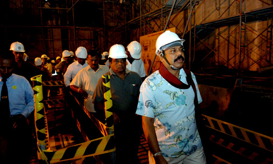
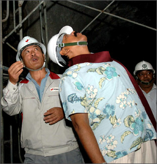
President Mahinda Rajapaksa on Friday inspected the Upper Kotmale
Hydropower Project and directed officials to expedite the construction
work.
 The Upper Kotmale hydropower project will fulfil a long-felt need for
additional power. It has an installed power of 150 MW (two 75 MW units). The Upper Kotmale hydropower project will fulfil a long-felt need for
additional power. It has an installed power of 150 MW (two 75 MW units).
Once operational, it will output 409 GWh per year. The dam will be
located near Talawakele and an underground powerhouse at Niyagammodara.
These will be linked by a tunnel. The project area covers some 540
square Km of the upstream catchment of the Kotmale Oya, a tributary of
the Mahaweli Ganga.
This is believed to the last major feasible hydropower project in the
country, though some more sites have been identified for medium scale
projects. The project is now in progress. The US$ 950 million project is
funded by the Government of Japan. It is due to be completed by 2011.
The affected residents are resettled nearby, with Talawakele being
turned into a fully developed city with all facilities.
The project was delayed due to various reasons under several
Governments, until the present Government took a firm decision to go
ahead with it in 2006.
The distribution of power consumption in 2002 was 39.5% for
industrial use, 19.4% for commercial use and 40.9% for domestic and
religious use.
 The growth in electricity demand has closely followed the growth in
the economy in recent years, emphasising the need for a reliable and
uninterrupted supply of electricity provided at a reasonable price if
the current trend of economic growth is to continue. Forecasts prepared
by CEB in 2003 shows that an additional 3228MW of generating capacity
would be required over the next 15 years. The 150MW provided by the UKHP
would therefore be an essential addition to the country's generating
capacity. The growth in electricity demand has closely followed the growth in
the economy in recent years, emphasising the need for a reliable and
uninterrupted supply of electricity provided at a reasonable price if
the current trend of economic growth is to continue. Forecasts prepared
by CEB in 2003 shows that an additional 3228MW of generating capacity
would be required over the next 15 years. The 150MW provided by the UKHP
would therefore be an essential addition to the country's generating
capacity.
The UKHP is a run of river hydropower project with an installed
capacity of 150MW (consisting of two 75MW units) and it will produce
409GWh per year. It has the following components:
A dam located close to the town of Talawakelle with a height of 35.5m
and a crest length of 180m. It will have a gross storage of 2.5 MCM with
an effective capacity of 0.8 MCM with a surface area of 0.25km2 (60
acres).
Full supply level for the reservoir will be 1,194 metres above mean
sea level (msl), the minimum operating level will be 1190m msl and the
normal tail water level 703m msl.
A headrace tunnel 4.5m/5+.2m in diameter lined and unlined and
12.89km in length, running north from the dam towards the Pundal Oya
Falls before turning to the northwest towards the existing Kotmale dam
and reservoir.
(The maximum gross head between the reservoir and the powerhouse will
be 491m).
An upstream surge tank 12m in diameter and 98m high with a restricted
opening, located on the crest of the power house.
 The penstock formed by an underground incline shaft starting with a
diameter of 4.5m and reducing to 1.45m. It will be 793m in length,
consisting of one lane of 745m and two lanes of 48m. The penstock formed by an underground incline shaft starting with a
diameter of 4.5m and reducing to 1.45m. It will be 793m in length,
consisting of one lane of 745m and two lanes of 48m.
An underground powerhouse located at Niyamgamdora, (2km upstream of
the confluence of Puna Oya and Kotmale Oya) with dimensions of 66.3m L x
18.8m W x 36.5m H to house two units of 77,000kW turbines, two vertical
axis three phase 88,000kVA generators, two 3-phase transformers and a
220kV Gas Insulator Switchgear (GIS) substation.
An outdoor switchyard, 36.5m wide and 130m long, located at
Niyamgamdora, to connect the Power House to a 220kV double circuit
transmission line.
220kV double circuit transmission line of 18km length to transmit
power generated to existing Kotmale Substation and the associated switch
yard extensions.
The Upper Kotmale Hydropower Project (UKHP) was conceived with the
preparation of a master plan for hydroelectric development in the
Mahaweli Basin in 1968. The concepts in the master plan were further
studied in 1985-1987 when the Government of Japan funded a feasibility
study to examine Hydropower options in the Upper reaches of Kotmale Oya
(Stream). Five sites and eight alternative development schemes were
examined in the feasibility study and the report concluded that the
development of two sites were technically and economically feasible. The
two sites were a reservoir type development at Caledonia and a run of
river project at Talawakelle. The project at Caledonia involved the
displacement of 2700 families and inundation of large area of tea land.
The Government of Japan then provided further funding for the
Engineering Service Study, which included the review of the feasibility
study, selection of the optimal development plan, the development of the
detailed design and preparation of Tender Documents and an Environmental
Impact Assessment Report (EIAR). The EIAR was issued in September 1994.
The Final Design Report was completed in March 1995. The
Environmental Impact Assessment identified key issues associated with
the UKHP as, impacts on water fall aesthetics due to stream flow
reductions, social impacts due to resettlement of affected people,
possible effects on ground water due to tunnelling, impacts due to
de-watering of streams on down stream water uses and impacts on
bio-diversity. |


