Using GIS to fight crime
by Nimal Lewke - Formerly Senior Dig / Commandant /
STF
To prevent and deter crime, Intelligence is the key to success, it is
the most vital aspect to identify the threat in advance and to
neutralise crimes in an area.
 The biggest achievement in our time, in the history of this country,
is the defeat of LTTE Military capabilities, to achieve this landmark
intelligence played a key role. The biggest achievement in our time, in the history of this country,
is the defeat of LTTE Military capabilities, to achieve this landmark
intelligence played a key role.
Police Criminal Intelligence apparatus have to take a harder look and
should make a practical attempt to enhance this valuable asset to
counter crime.
When you analyse intelligence there are two important areas , that ,
we have to consider.
A) Human Intelligence
B) Technical Intelligence
My observation is based on Technical Intelligence, as we in the STF
were the pioneers that identified the LTTE code system and intercepted
the radio communication links to our advantage and built a very
effective Technical Intelligence system.
Considering the lessons learnt over the years, it is advisable to
take a closer look, and see what method that can be adopted to enhance
the Criminal Intelligence in the Police to counter crime. It is
important to analyse and implement a plan to produce results.
Tactical analysis of crime, access to timely accurate information for
problem solving, community policing, crime prevention is a must to
maintain law and order in the country.
In recent times, killings in the Kahawatte police area were a glaring
example, but, what is the method that will help Police to apprehend
culprits like in Kahawatte. This can be identified as a Hot Spot area
and it occurs in a relatively small area. The strategy for crime
suppression by use of GIS to map one or more reported offences make it
an invaluable tool to identify the pattern and to map-out strategies to
counter.
In 2002, snipers terrorised the Washington DC. The police used GIS to
link 13 separate attacks in several states. This proves that it gives a
clear picture to identify the threat and counter same. In Sri Lanka we
use the crime clock to monitor crime in a police area. One wonders how
effected this system is. Whether it caters to the present demand. For
tactical crime analysis, crime pattern is by positioning different
coloured pins on wall maps. Many crimes have been solved by representing
and recognising spatial patterns of crimes, but maps and boards have
major limitations. Once the map was removed this spatial analysis is
lost unless photographed.
Also, the map could easily become overcrowded. Data could not be
added or removed. To overcome these shortcomings the best is to use the
GIS System.
The goal of using GIS System can overcome some of the shortcomings of
traditional policing where reactive response to 119 call service are
concerned. Competent analysis provides important information to decide
the deployment of police resources to prevent and suppress criminal
activity.
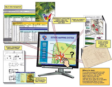
What is GIS (Geographic Information System)?
A Geographic Information System (GIS) integrates hardware, software,
and data for capturing, managing, analysing, and displaying all forms of
geographically referenced information. GIS allows us to view,
understand, question, interpret, and visualise data in many ways that
reveal relationships, patterns, and trends in the form of maps, globes,
reports, and charts.
A GIS helps you answer questions and solve problems by looking at
your data in a way that is quickly understood and easily shared. GIS
technology can be integrated into any enterprise information system
framework.
Today it is used all over the world for crime prevention and help
police to take control and dominate their respective areas and win the
confidence of the residents in those areas.
STF studied the basics of GIS / GPS and made use of same during the
final stages of the war in the East.
It was highly successful and gave immense confidence to the troops
and leaders whenever they planned operations.
When former IGP Chandra Fernando entrusted the STF to track down the
underworld operations in 2005 / 6. GIS was the key to identify the
movements, routes, location, which resulted in STF carrying out very
successful operations (20 STF Officers underwent basic GIS Training at
the Moratuwa University).
During my stint as Senior DIG/Wayamba Province, I selected a group of
police officers to follow a basic GIS training program at UDA under
Indrasiri and made an attempt to introduce the system as a pilot project
and basic preparation was done, but it could not be implemented.I
believe that we have to update the knowledge of the police with all
available resources, technical assistance, specialised training to meet
the demand in a vastly advancing and changing society.
The introduction of the GIS System with basic software will give a
clear picture to the SSP of the Division which will enable him to map
out his plan, vision and strategy to counter the ever increasing crimes,
drug offences, accidents, murders and robberies. The GIS System will
definitely enhance the investigation capabilities and counter measures
that require to meet the present demand, if the police approach this
facility with a practical mind. It will definitely help the police in
their day-to-day duties which in turn will enhance their image and win
the confidence of the masses.
|


")


